|
|---|
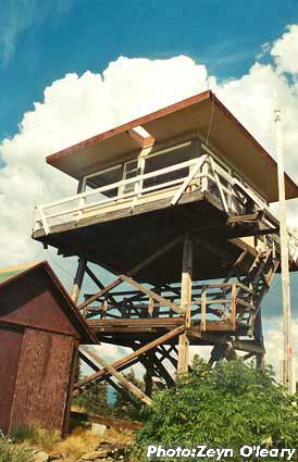
| MOUNT PISGAH LOOKOUT | |
|---|---|
A 10' platform was built here in 1918, replaced by a 35' platform and accompanying cabin in 1923. A cab was constructed atop the existing tower in 1929, followed up by a 20' L-4 tower in 1933. In addition, there were patrol points 1 mile north (burned in a 2008 forest fire) and 3 miles east. The present 20' treated timber R-6 flat tower, built in 1964, is staffed every summer. |
|
| Ochoco National Forest | |
| 8 miles southwest of Mitchell | |
| Wheeler County, Oregon | |
| Elevation 6816' | |
|
|
|---|