|
|---|
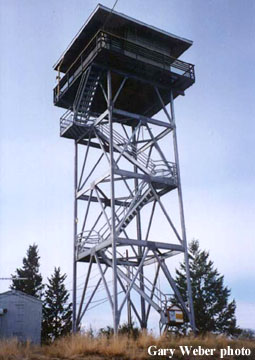
| BLACK BUTTE LOOKOUT | |
|---|---|
Initially used as a patrol point in the 1920's, the first tower built was a 35' pole L-4 in 1939. In 1973, an 8x8' cab was installed atop the radar installation, with no living quarters. The present 45' all-steel live-in tower was constructed in 1983. |
|
| Kootenai National Forest | |
| 3 miles southwest of Eureka | |
| Lincoln County, Montana | |
| Elevation 4064' | |
|
|
|---|